Monitoring Of Water Consumption

Project Overview
Year
About
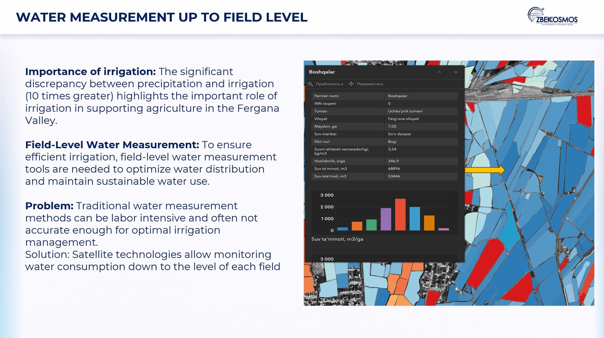
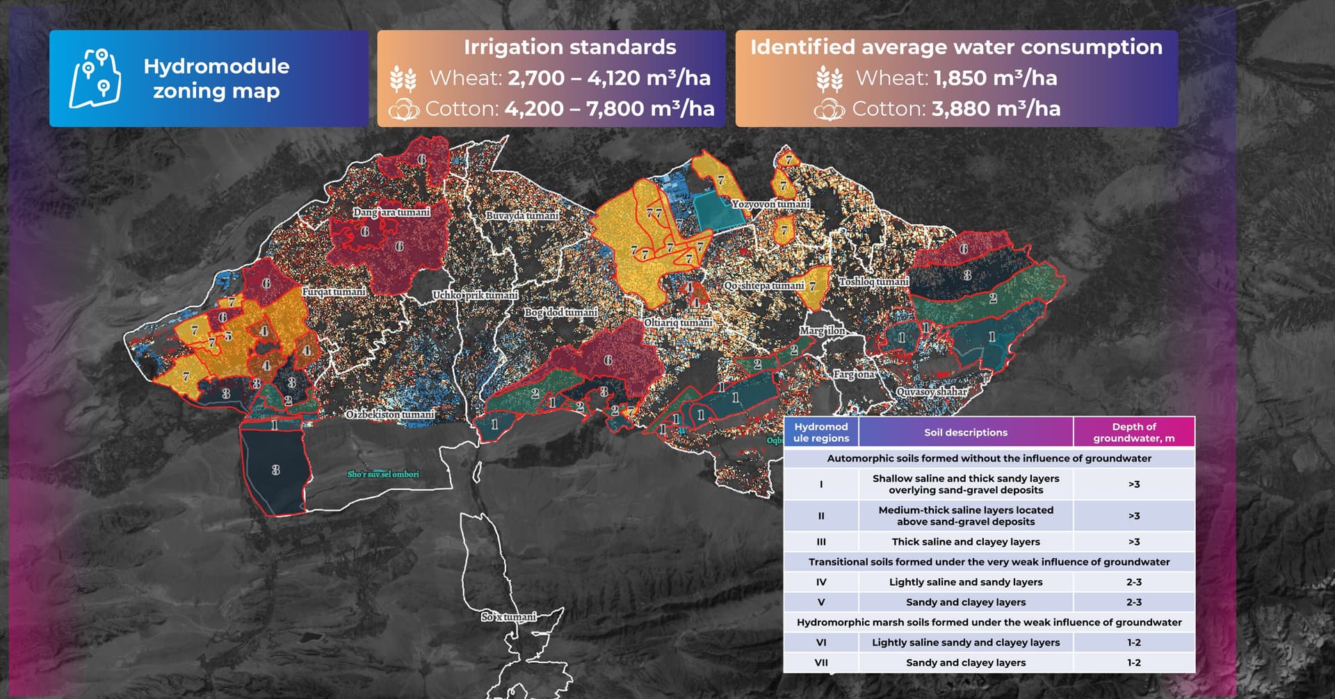
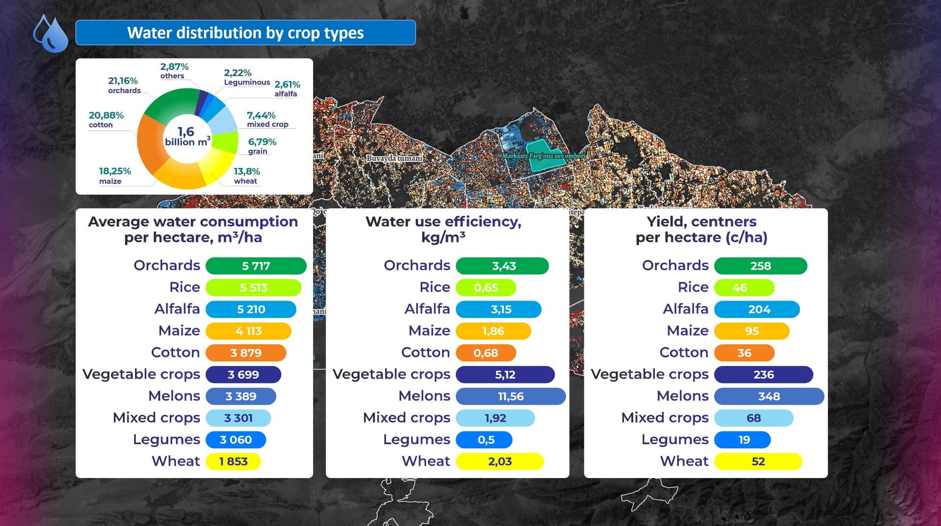
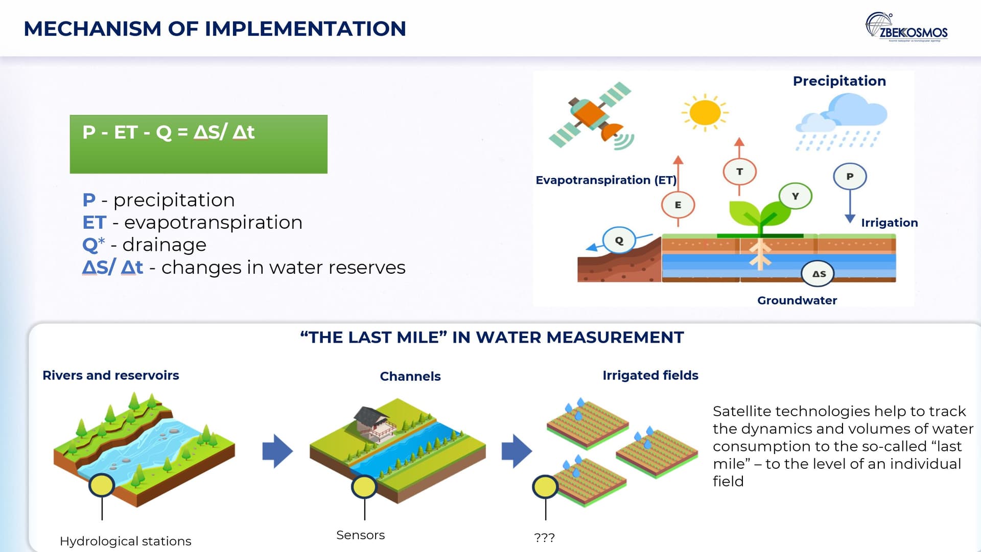
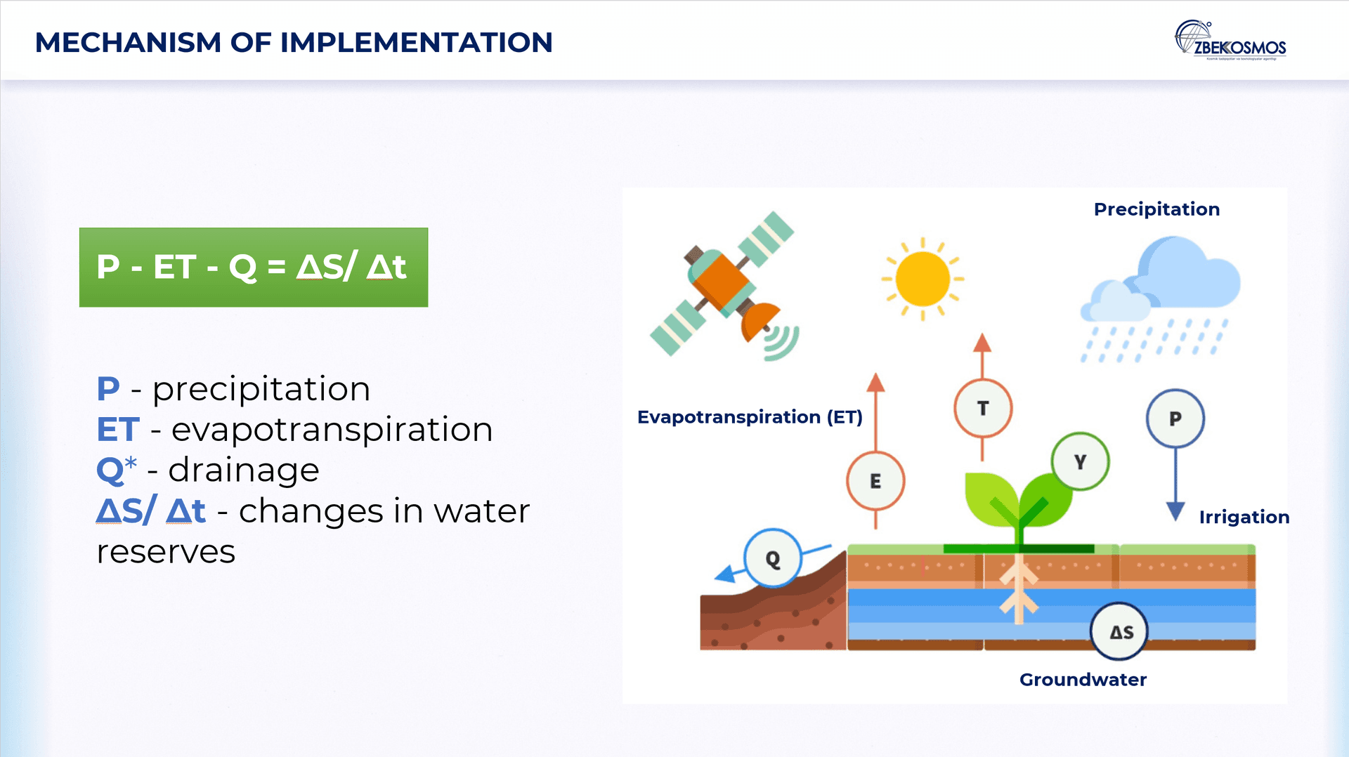
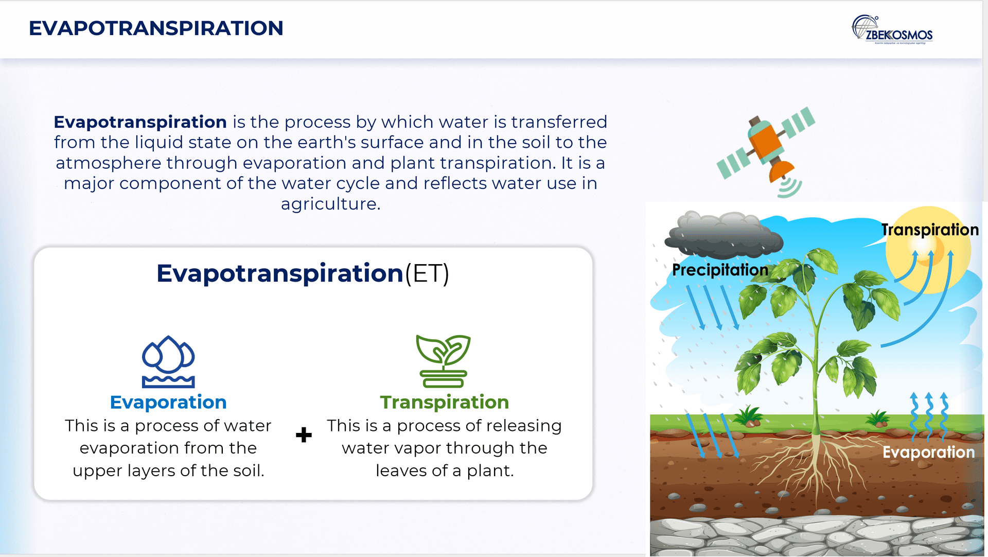
Combining satellite imagery, field data, and advanced analytics, this system monitors water use and improves irrigation efficiency in Uzbekistan’s Fergana region. By mapping over 17,000 km of canals and 312,000 hectares of farmland, it calculates crop water consumption and identifies areas of over- or under-irrigation. A dedicated geoportal provides real-time insights for farmers and policymakers, supporting better water planning, yield forecasting, and sustainable resource use in regions facing increasing water stress
Team

Jakhongir Iskhakov

Dr. Gayrat Yakubov
Supervising Professor

Jakhongir Mirzo Khafizov
"My name is Jakhongir Khafizov from Uzbekistan. There I manage projects that apply satellite data to real challenges in agriculture and environmental monitoring. Using satellite imagery, we identified areas of water stress and inefficiency and the results supported local authorities in improving the distribution of water in a water-scarce region I aim to bring a data-driven perspective on sustainable resource management while learning about climate resilience and collaborative approaches from others. I aim to bring a data-driven perspective on sustainable resource management, while also learning from others about climate resilience and collaborative approaches."
Gallery